Related Articles
With a course of about 64 km long, we will head south to a scenic route at Tzvaim plateau, overlooking Harod valley and Gilboa ridge to the south, Issachar valley and plateau to the north, Mount Tabor and Givat Hamore to the west. From there, we will descend to Issachar stream, which is the southernmost stream out of large streams of the Lower Galilee, with 21 km long.
The Trail
Head south along Kama stream to Kfar-Kish access road, cross the road to a trail marked in red, that leads to Tavor stream. After about 1.38 km, turn south to Shemer stream, which leads to Kafr Misr. After a short drive crossing the village, you’ll reach the junction with Route 7276 that leads to Gazit. Cross the road and take the gravel trail leading to Tamara. After about 1.35 km, head south-east down the spur. A scenic viewpoint, with benches and stone tables, is located just before spot height #214.
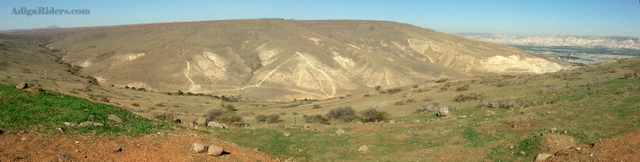
Continue towards hamlet Ramat Tzvi and cross Highway 717. Shortly after, cross Tzavim stream and keep going until you get to Ramat Tzvaim scenic route (marked green). Head east along the route overlooking Harod Valley and Gilboa ridge to the south, Issachar valley and plateau to the north, Mount Tabor and Givat Hamore to the west.
The route provides viewpoints for observation and rest. The scenic route extends for about 10 km and ends at the Industrial Park of Ramat Tzvi. Keep westward for another 3 km until you get to a steep descent into Issachar stream.
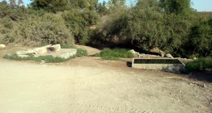
The descent is steep and rocky. Turn right at its end to the stream passage. After crossing the water, turn west and take the main track (marked blue) that runs for about 9 km inside the channel. Issachar stream has steep and challenging inclines, alongside the central route, for those who like to add adrenaline to the trip. Those who do not want to test their 4X4 capabilities should continue eastward on the blue track. Trees are scattered along the stream providing shade for a coffee break.
After about 4 km, a red trail goes out from the channel leading to the Belvoir fortress. Make sure not to get disoriented or go astray there, and continue on the blue track. Just before Moledet, take the track leading north which is marked in black and drive back to route 7276. Take the road for about 1.8 km to the entrance of Kafr Misr. From here make your way back along the same route.